One Mission to Measure two Vital Signs of the Earth with Breakthrough Coverage & Vertical Accuracy to Observe Critical Regions
EDGE IS THE FIRST GLOBAL SWATH-IMAGING LIDAR
- Revolutionary global view: First satellite imaging laser altimeter system positioning the US at the forefront of global technological innovation to monitor land, ice, and coastal regions simultaneously
- American engineering advantage: Entirely US developed 40-beam design combines proven GEDI technology with an agile Maxar production spacecraft to deliver greater global coverage than all prior missions combined, and the first rapid targeting capability achieved by a satellite lidar
- Strategic geospatial dominance: Essential step toward a commercial swath imaging lidar altimeter constellation ensuring American leadership in global topographic situational awareness
EDGE PROVIDES HIGH VALUE TO THE NATION
- Competitive edge for market acceleration: Delivers high-demand data to decision-makers and companies, driving insights for logistics, risk management, and strategic planning
- Innovation catalyst: Provides scientifically verified measurements that drive economic growth across industries, powering next-generation analytics for resource optimization, precision management techniques, and strengthened domestic supply chains through enhanced geospatial awareness
- Technological leverage: Power business operations with comprehensive tracking of crop productivity, water resources, and land use to enable smarter agricultural planning, wildfire prevention, and resource management
EDGE SAFEGUARDS NATIONAL SECURITY
- Technological sovereignty: Maintains the United States as a global leader in topographic lidar, directly advancing national security interests
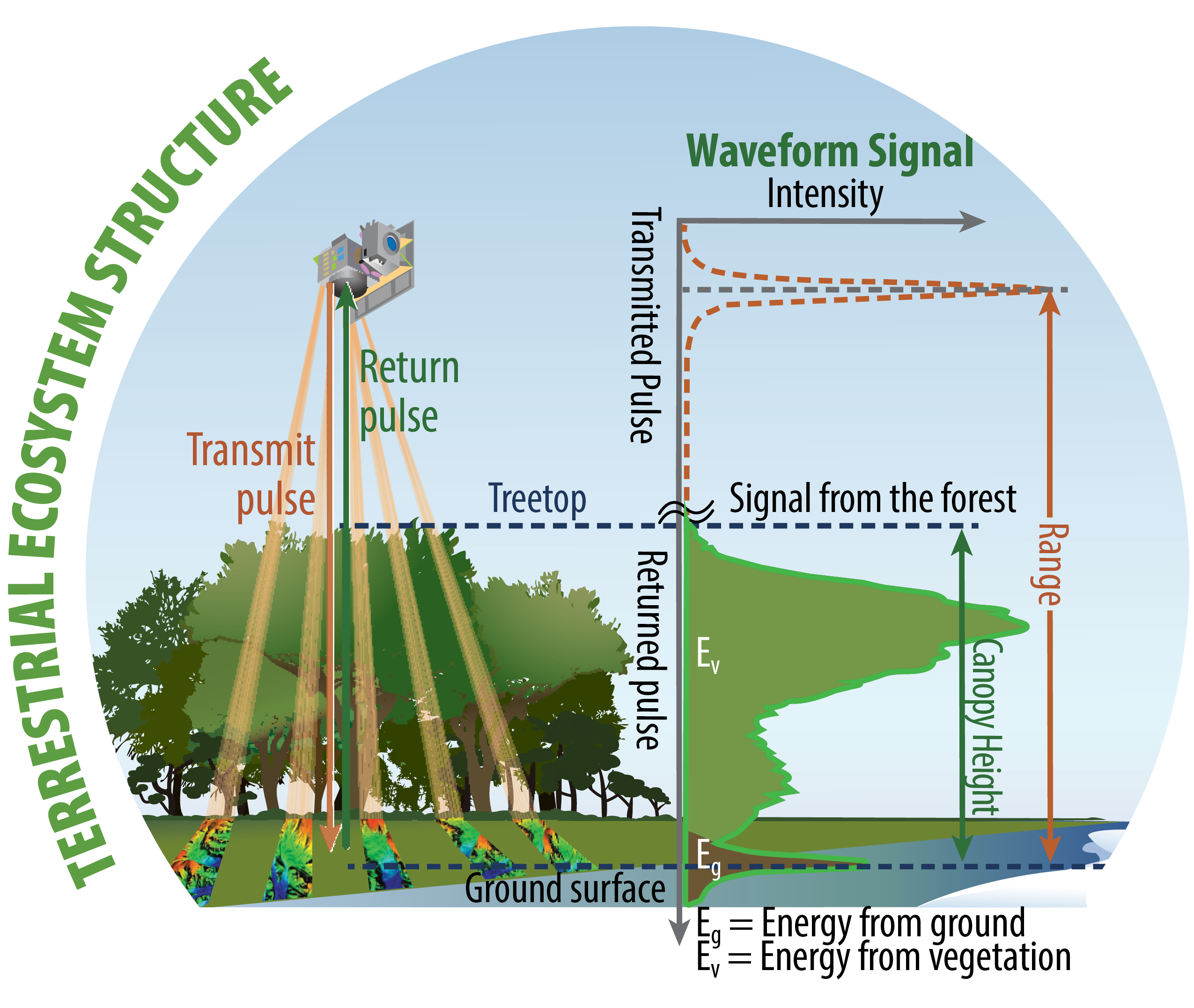
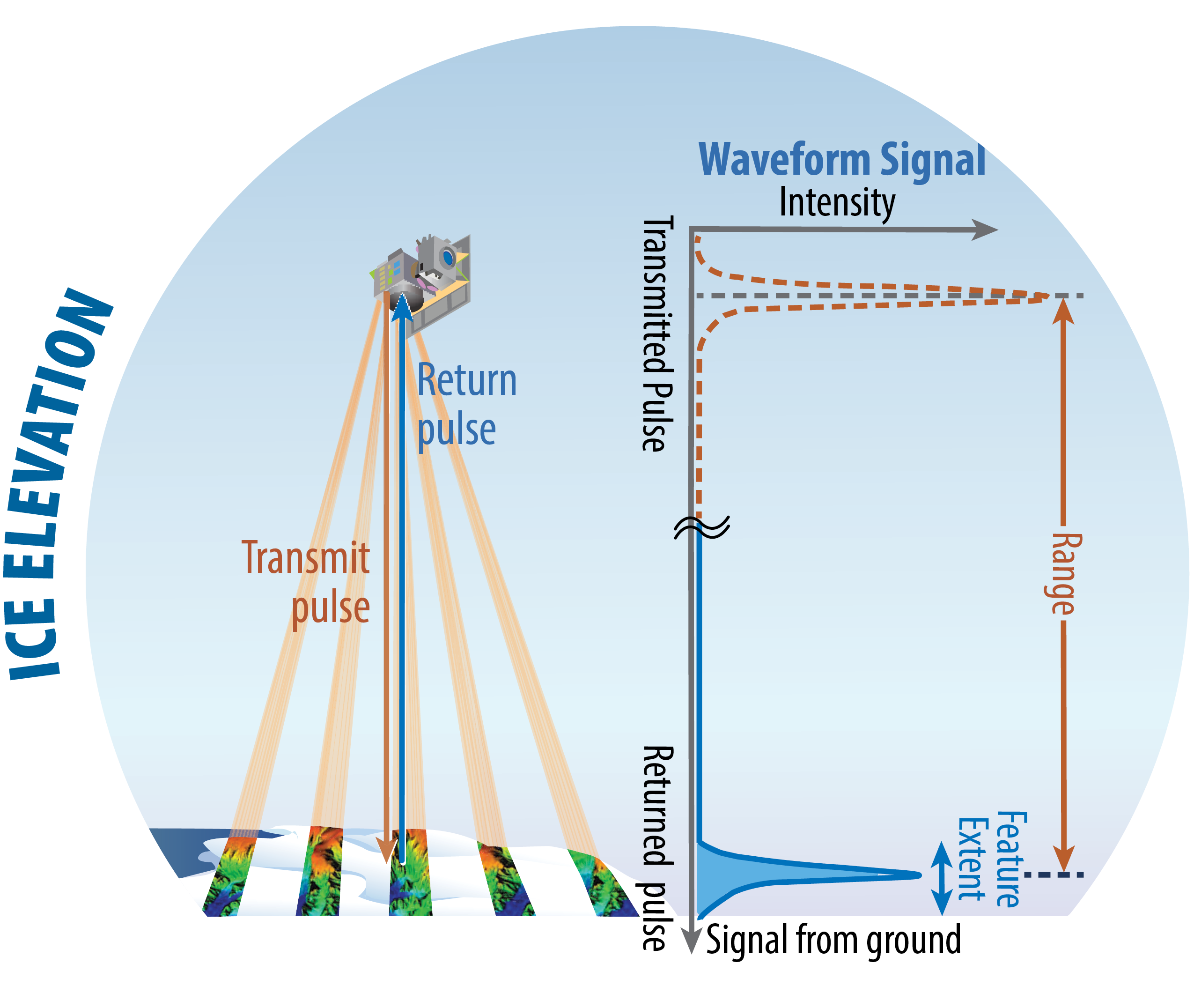
- Unparalleled geospatial acuity: Laser altimetry is the only technique with sufficient canopy penetration and vertical accuracy to simultaneously track 3D changes in terrestrial systems and critical ice regions
- Persistent terrain monitoring: Order of magnitude greater vertical accuracy than any other space-based measurement provides inputs for timely analysis for critical assets, land and sea transportation corridors, and terrain in areas of national importance
EDGE NEWS
Intuitive Machines to acquire Lanteris Space Systems (formerly Maxar Space Systems)
4 November 2025
Intuitive Machines, a company that develops lunar landers and other vehicles, announced Nov. 4 it is buying Lanteris Space Systems, a satellite manufacturer formerly known as Maxar Space Systems.
EDGE Site Visit at NASA Goddard
25 September 2025
 On September 25, 2025, EDGE PI Helen Fricker, Deputy PI John Armston, Deputy PI Bryan Blair, Project Scientist Scott Luthcke, and the whole EDGE team welcomed the ESE Evaluation Panel to present the EDGE mission during a Site Visit.
UPCOMING
EDGE Sesssions at AGU 2025
18 December 2025
EDGE, in partnership with STV, will be hosting two Oral Sessions at AGU25:
G43A & G44A- Advances in Geodetic Mapping of Earth: Tracking Earth’s Changing Surface, Including Solid Earth, Cryosphere, and Ecosystems
EDGE captures accurate 3D data crucial for national security, economic prosperity, and strategic advantage—pioneering next-generation space laser technology
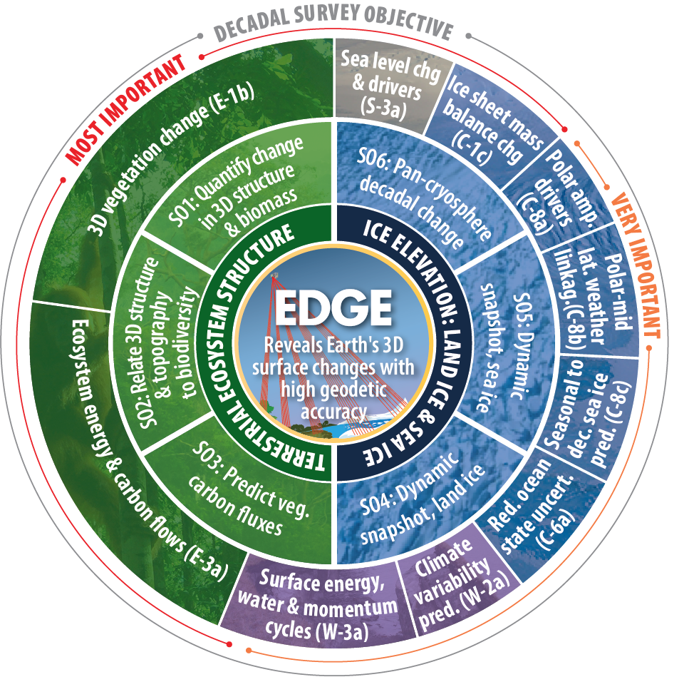
EDGE’s “wheel of science” shows its transformative connectivity across the Earth system enabling new avenues for scientific discovery. By connecting studies of TES and IE, EDGE explores their roles in the Earth’s water, carbon, and energy cycles.
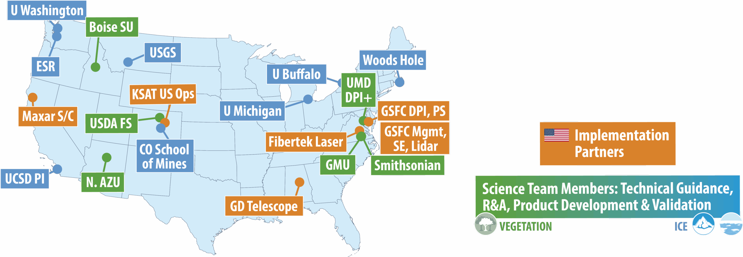
EXPERIENCED HIGH PERFORMERS
EDGE combines world-class expertise in geodetic remote sensing (from the successful ICESat-2 & GEDI missions) to track dynamic Earth processes and deliver the nation’s next-generation global baseline elevation map.
To learn more about EDGE team members, click here.
EDGE INSTRUMENT TEAM delivered THE CLASS C GEDI INSTRUMENT ON TIME & ON BUDGET
All of GSFC’s competed Explorer class missions over the past 15 years were delivered on budget.
PlanetaryX, CEO: “...reliable, high-resolution data that has undergone robust scientific verification is essential for market growth. We see the EDGE data as an absolute priority.”