INSTRUMENTATION
EDGE’s swath-mapping lidar delivers unprecedented coverage with high accuracy to measure critical regions
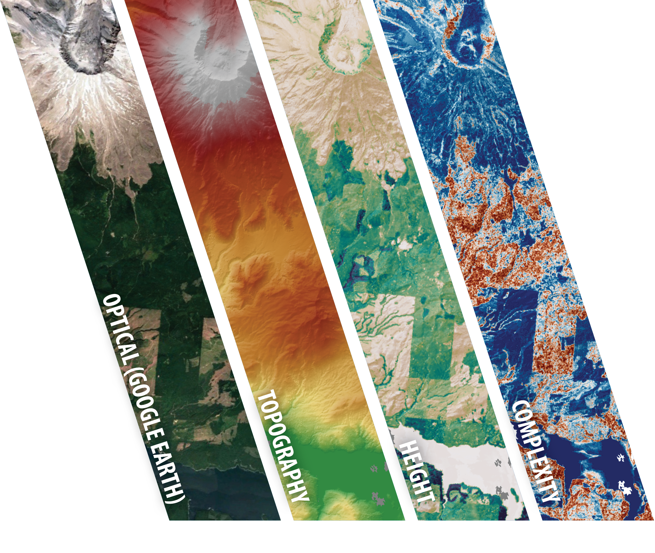
RIGHT IMAGE: NASA Land, Vegetation, and Ice Sensor (LVIS) demonstrates EDGE’s baseline mission across Mount St. Helens, highlighting capabilities previously only possible for limited areas via airborne systems. Laser altimetry is the only technique that can see through the vegetation to measure its 3D structure and the underlying topography
One Instrument, Two Vital Signs of the Earth
NEXT GENERATION
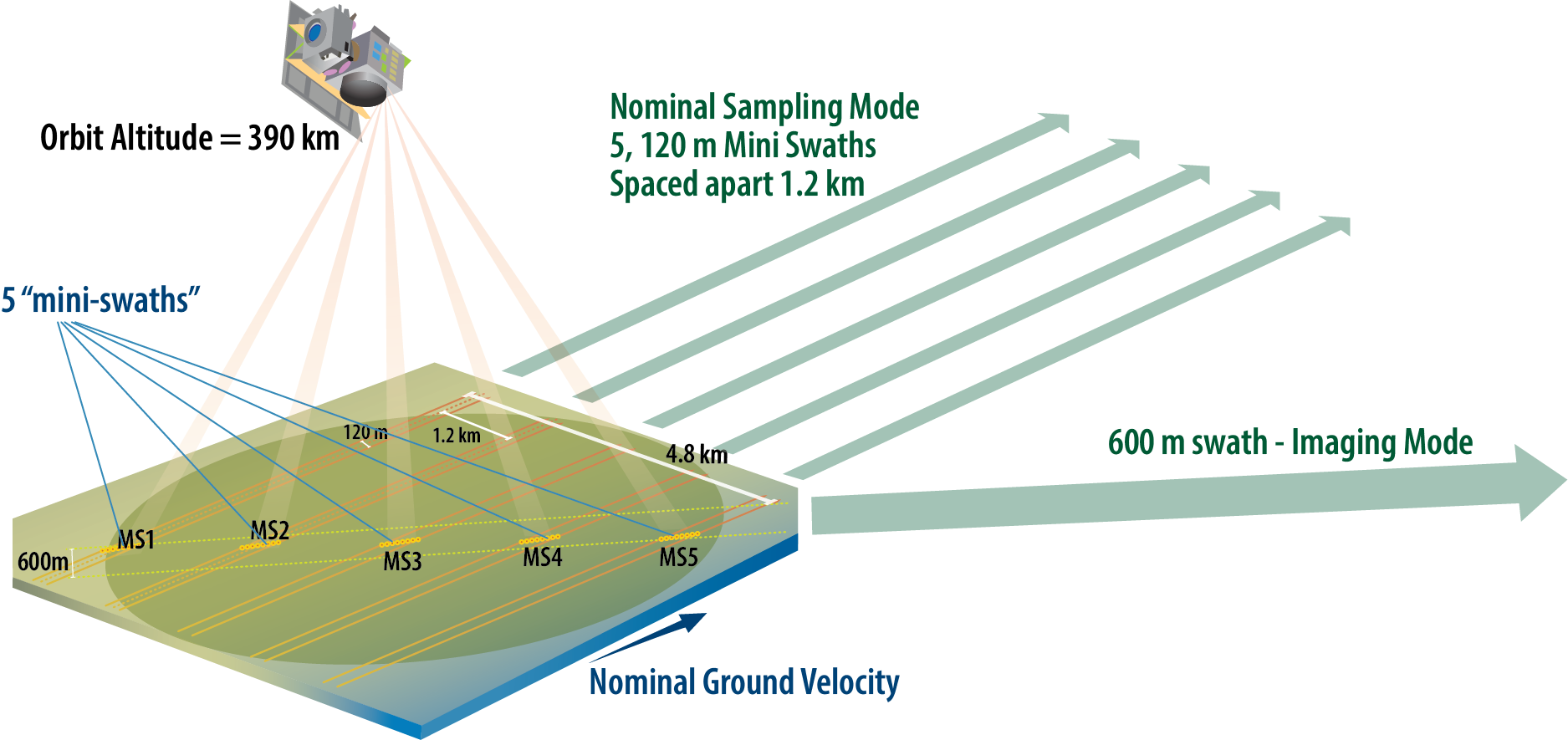
Solid-state scanning splits each of 5 lasers into an 8-beam mini-swath, representing a novel advance from multi-beam profiling (GEDI & ICESat-2) to swath-mapping with geodetic waveform-recording laser altimetry.
HIGH HERITAGE
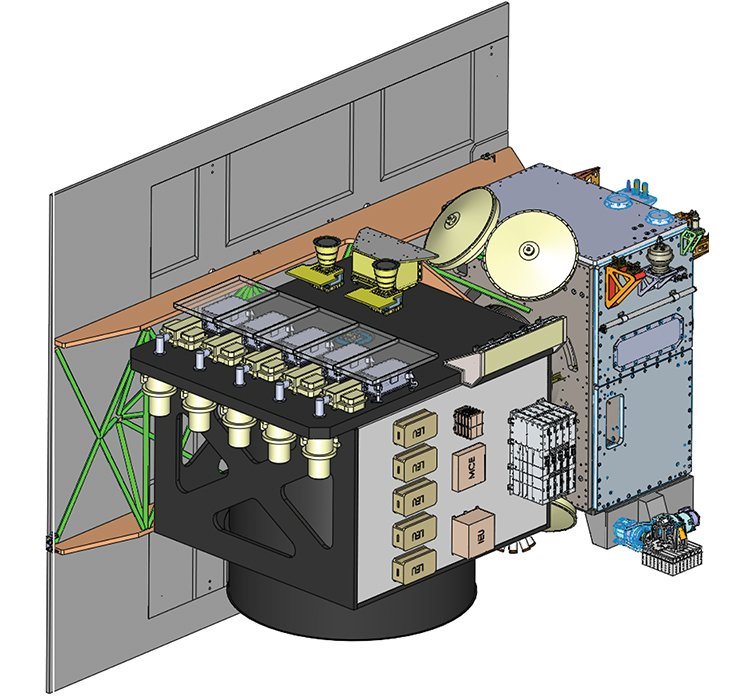
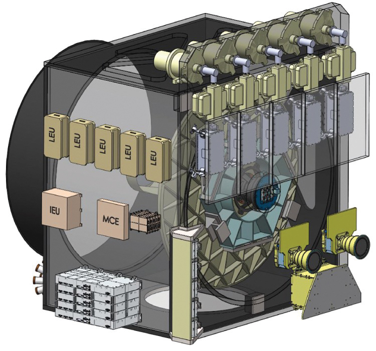
Fibertek’s high-efficiency, single-stage lasers in combination with General Dynamics’ 1.2 m Be telescope and GEDI scanning technology leverage heritage to maximize sensitivity, coverage, and resampling to track dynamics.
TRANSFORMATIVE
Order-of-magnitude improvement in spatial and temporal sampling, combined with increased accuracy (< 3 m horizontal and < 8 cm vertical on low slopes), enables 3D observation of key Earth system changes at the scale of their driving processes.
MULTI-PURPOSE TECHNOLOGY Terrestrial Ecosystems+Ice Elevation+Safe Landing for Exploration
The EDGE team developed NASA STMD’s Hazard Detection Lidar for safe landing on Moon, Mars, & beyond enabling the instrument to be used for lunar & planetary exploration.
Total wet mass
1038 kg (MEV)
Total power
1275 W (MEV)
Daily science data volume
300 GB (MEV)
ORBIT
390 km Sun-synchronous dawn/dusk with seasonal exact repeat
DURATION
2 years
Expendables
5 years
STABLE & AGILE SPACECRAFT
Maxar provides an ideal stable platform for the EDGE lidar: their Legion 500 production bus with proven flight capabilities (six on orbit). Maxar has experience with geodetic measurements from space, with specific focus on a low-jitter environment for high-resolution electro-optic sensors. The spacecraft is in a 390 km sun-synchronous dawn/dusk orbit with a 90-day seasonal repeat track.
ROBUST MISSION
EDGE carries healthy margins in excess of 35% power, 25% data, and 550% launch (wet) mass. Select redundancies provide enhanced reliability, and the overall architecture provides the fault-tolerance, operational resiliency, and graceful performance degradation requisite for a Class C mission.
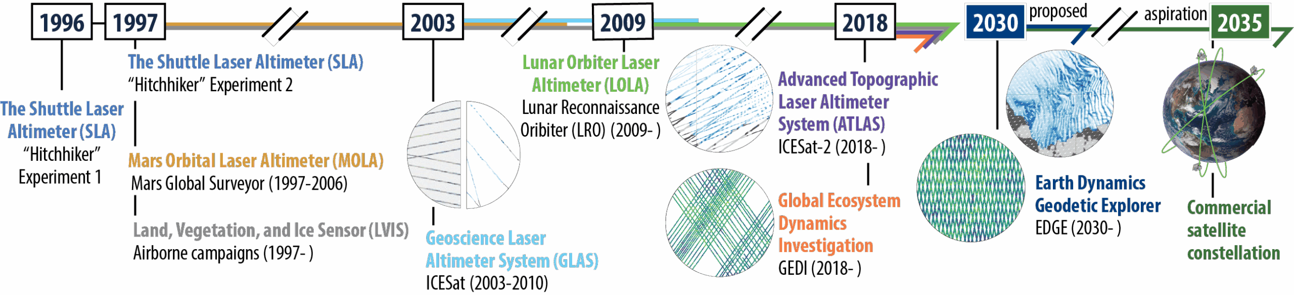
GODDARD'S PIONEERING LEGACY OF LIDAR DEVELOPMENT
FULFILLING TWO OF NASA'S EARTH SYSTEM EXPLORER TARGETED OBSERVABLES