SCIENCEOBJECTIVES
EDGE is designed to meet objectives for two Decadal Survey Targeted Observables: Terrestrial Ecosystem Structure & Ice Elevation
Goal
Terrestrial Ecosystem Structure
SO1: Quantify how the 3D vegetation structure and aboveground biomass of Earth’s wooded ecosystems has changed
SO2: Quantify how 3D vegetation structure and surface topography are related to habitat suitability and biodiversity for the Earth’s wooded ecosystems
SO3: Quantify woody vegetation carbon fluxes and sequestration potential in response to land use and change
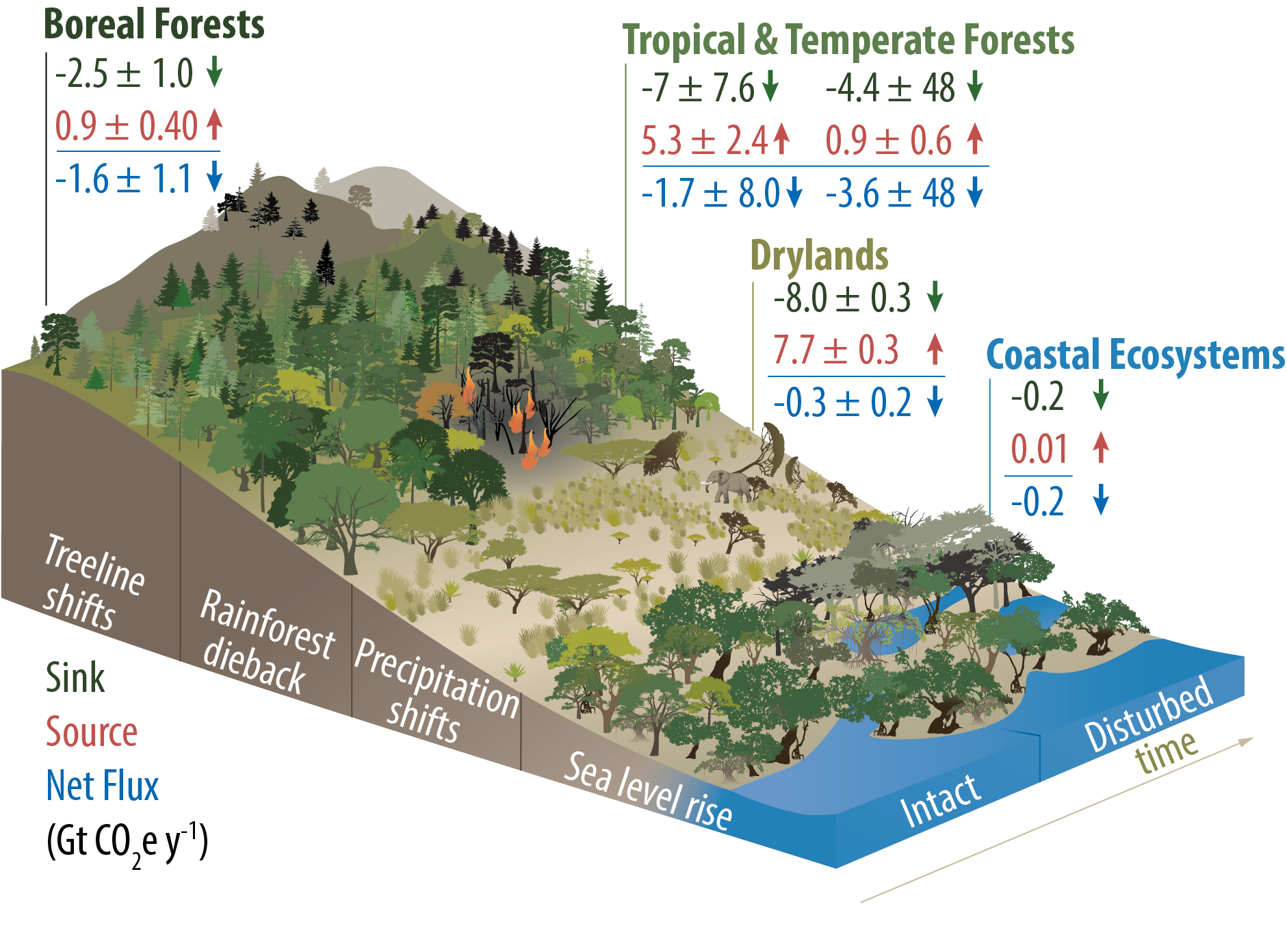
America’s forests are vital resources, supporting industries, local economies, and biodiversity. Yet, uncertainties in their carbon storage and response to land use make effective management challenging. EDGE delivers advanced data on canopy structure and aboveground biomass (AGB) with unprecedented precision, enabling better management of natural resources, fostering economic productivity, and supporting decision-makers in protecting these critical assets for future generations.
Ice Elevation
SO4: Quantify surface topography and short-term change of land ice at the spatial scale of features that are signatures of mass change processes in dynamic regions
SO5: Quantify freeboard, floe size and roughness of sea ice at the spatial scales of individual floes including in the marginal ice zone, and at the length scale of surface features of landfast ice.
SO6: Develop a high resolution Ice Elevation baseline reference for prior and following radar and laser altimetry missions to enable a record of decadal change in dynamic edges of the cryosphere
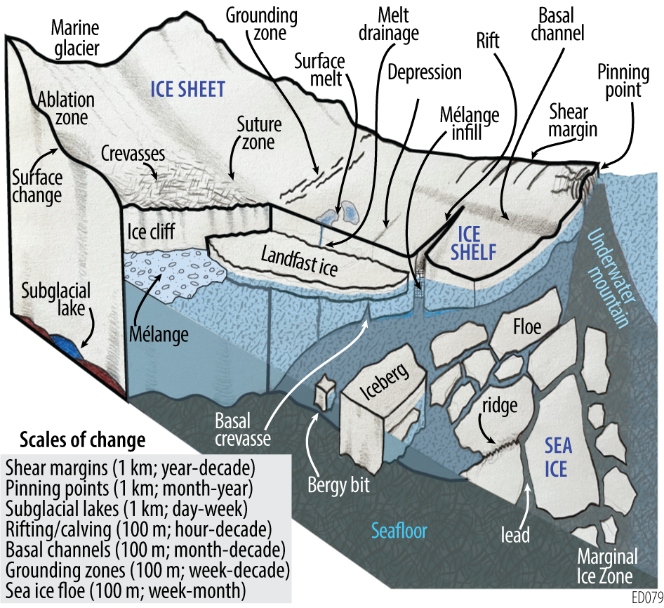
EDGE provides a new dynamic snapshot of IE over 2 years by mapping features that are signatures of processes driving land ice and sea ice change at relevant spatial scales and tracking their short-term evolution.